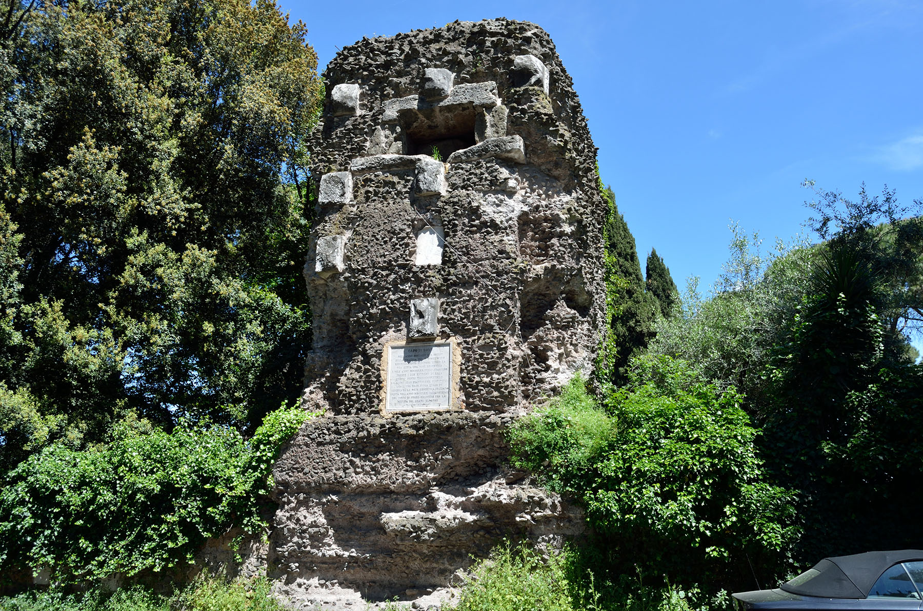
A little further than 500 m from the extreme A, on the left going towards Albano Laziale, there is an ancient sepulchre without cover, commonly called Torrazzo of Capo di Bove from the toponym of the surrounding area.
When measuring the base, p. Secchi realized that for the future use of his geodetic work it would have been more appropriate to choose an initial extreme with a better view of the horizon since the extreme A was surrounded almost completely by artifacts both to the north-east and to Southwest. With great foresight hechose, therefore, the aforementioned Torrazzo, indeed after almost 15 years, when the Italians entered Rome, the military topographers acquired in full the work of the Jesuit for the sketching of the national cartography.
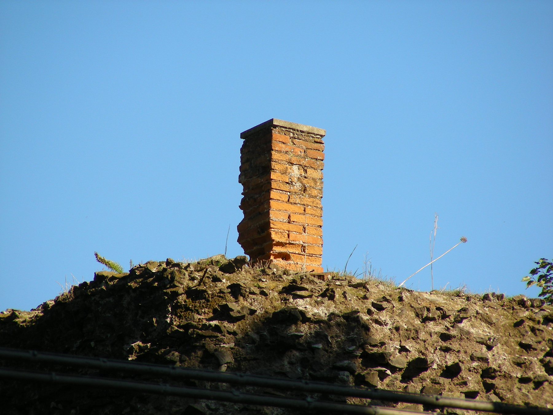
With the point on the Torrazzo, still identifiable by the pillar in bricks (Figure 1) that supports the metallic insignia, visible on the top moving a little to the opposite via Capo di Bove, was to form a new slightly shorter base , but better connectable to the Torre del Primo Meridiano d’italia located on Monte Mario and just 10 km far from it. This connection was necessary to unify the papal geodetic network with that of the Kingdom of Italy which had formed, in turn, from the subsequent union of the geodetic networks of the preunitary states.
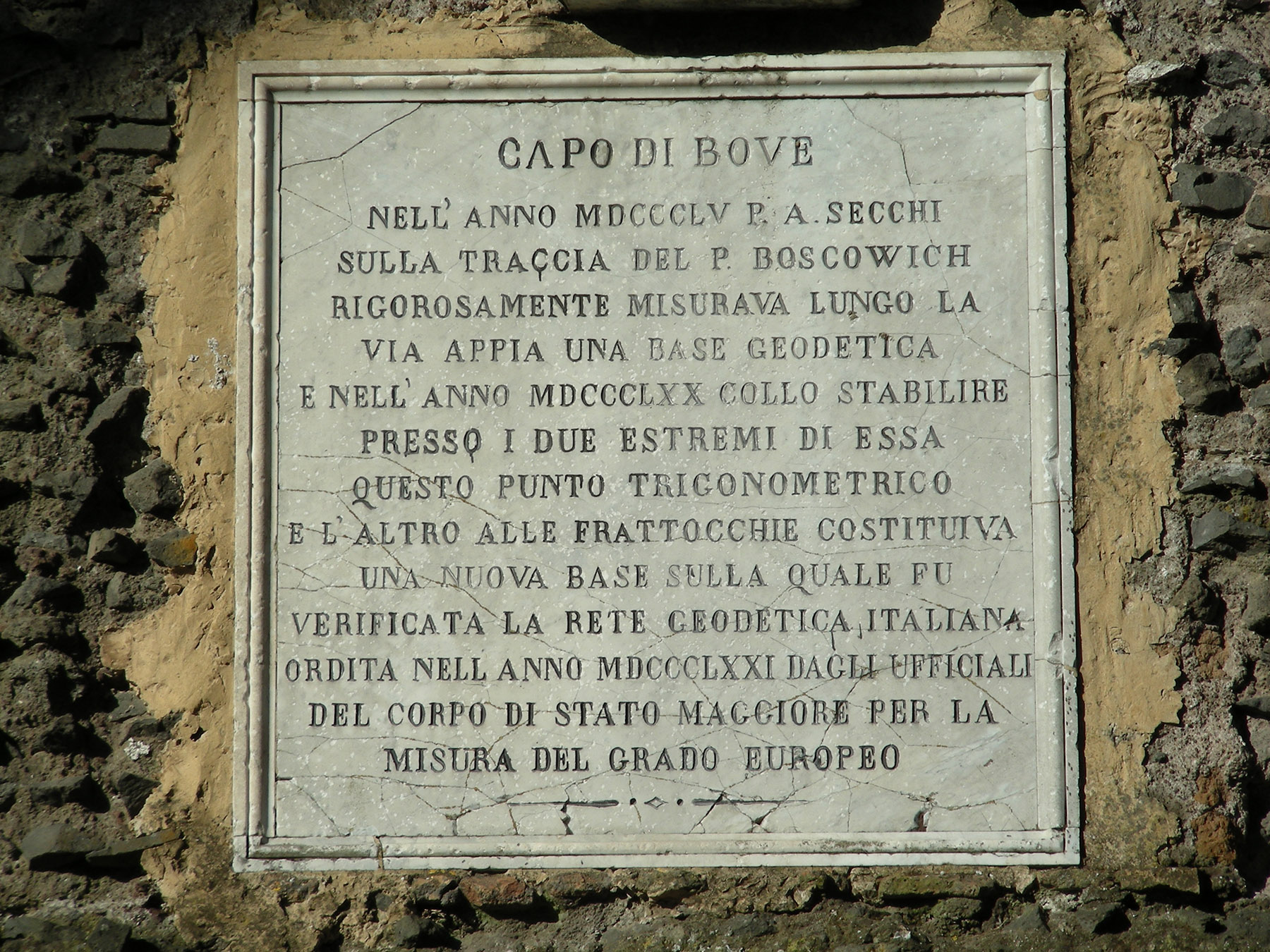
The monument is accompanied by a plaque (Figure 2), the only one that tells, albeit synthetically, about the geodetic measurements carried out along the ancient road. After 1880, the plaque was crushed by the explosion of a mine and recomposed. The last part of the plaque’s text refers to the great geodetic operation promoted by Prussia in 1861 for the measurement of a meridian arc passing through Central Europe in order to study the shape of the Earth, a topic of debate among scientists during the previous three centuries. Papal States officially joined this operation only in the end of 1869.
Extreme A ‘
Torrazzo di Capo di Bove, Via Appia Antica, Roma
41°50’54.7”N 12°31’29.0”E (datum WGS84-ETRF2000)
Bibliography
T. Aebischer, R. Fioravanti, a cura di: Angelo Secchi. Astronomo e fisico. Attualità scientifica e luoghi storici a Roma, Atti della Giornata di Studio (Biblioteca Casanatense, 10 giugno 2009), Città di Castello (PG), 2014, pp. 168; T. Aebischer: La via Appia Antica parco geodetico. Fonti letterarie e online sulle basi geodetiche di Boscovich e Secchi misurate per la cartografia dello Stato Pontificio e lo studio della forma della Terra (XVII-XXI secc.), Città di Castello (PG), 2014, pp. 233.