The geodetic base of P. Secchi ended at the extreme B which was buried near to an ancient Roman monument located in Frattocchie, one of the last interested by the archaeological excavations of Luigi Canina. The place was also, albeit identified in an unclear way because of the few details reported by P. Boscovich, seat of the extreme β of the Boscovichian base, which Secchi wanted to remeasure in response to the French criticisms.
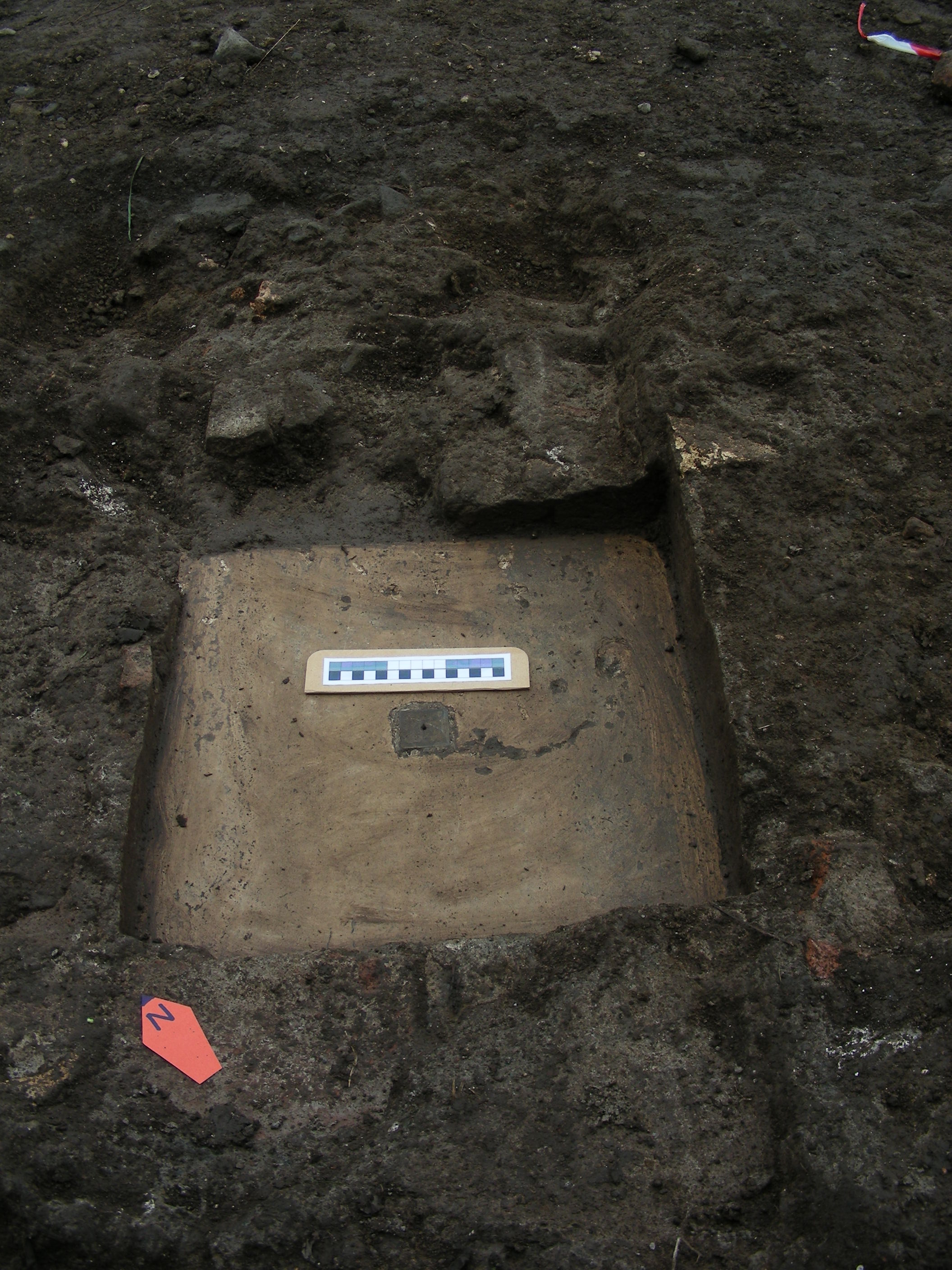
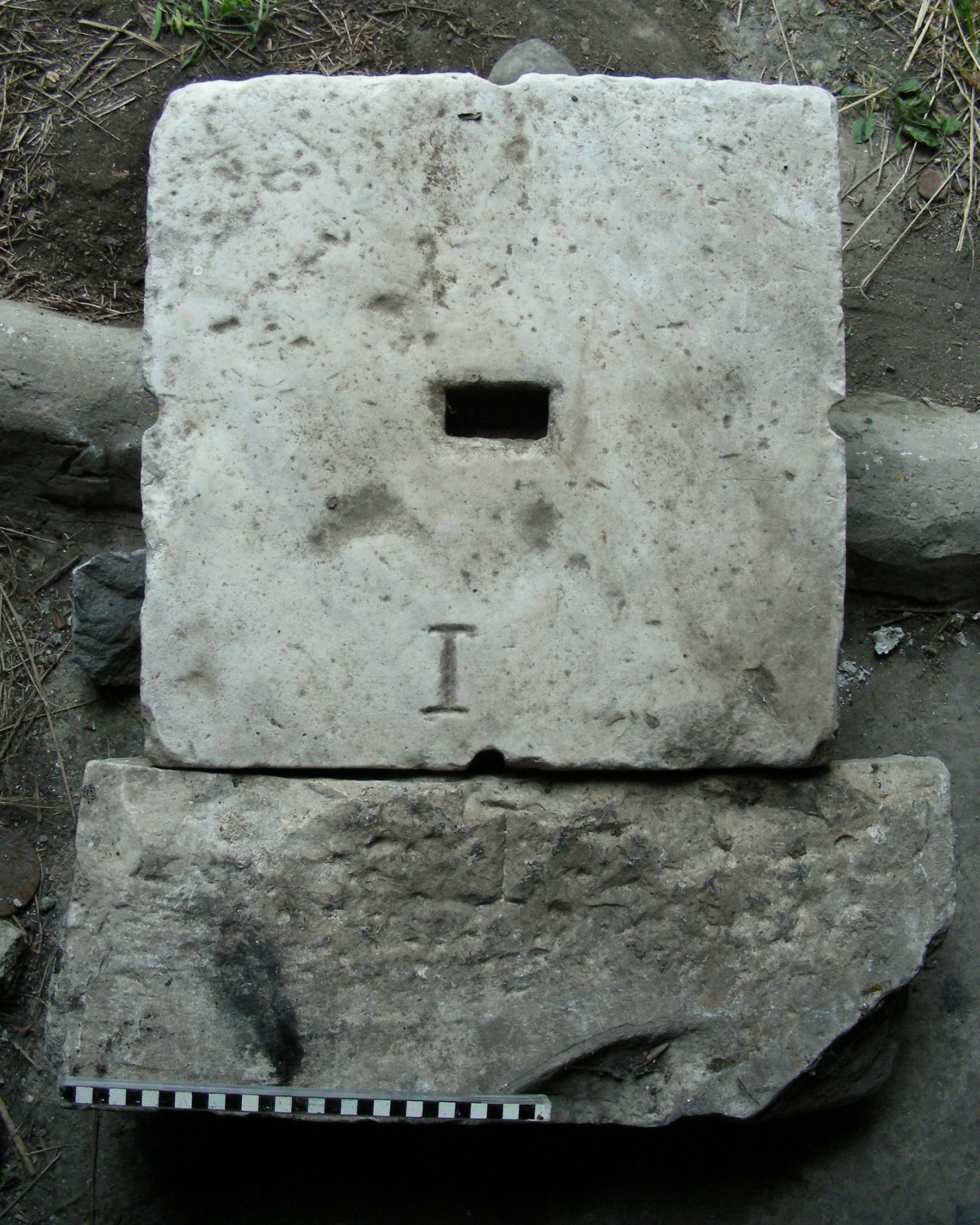
In 2013, following both bibliographic and georadar research of the University of Rome Tre, and in collaboration with Legambiente, the extreme B was brought to light (Figure 1). Since that moment the topographical surveys of the area are in progress with GNSS techniques by the website E42 in order to study the two extremes together and to reconstruct some information in the documentation of P. Secchi, but that on the ground disappeared with time.
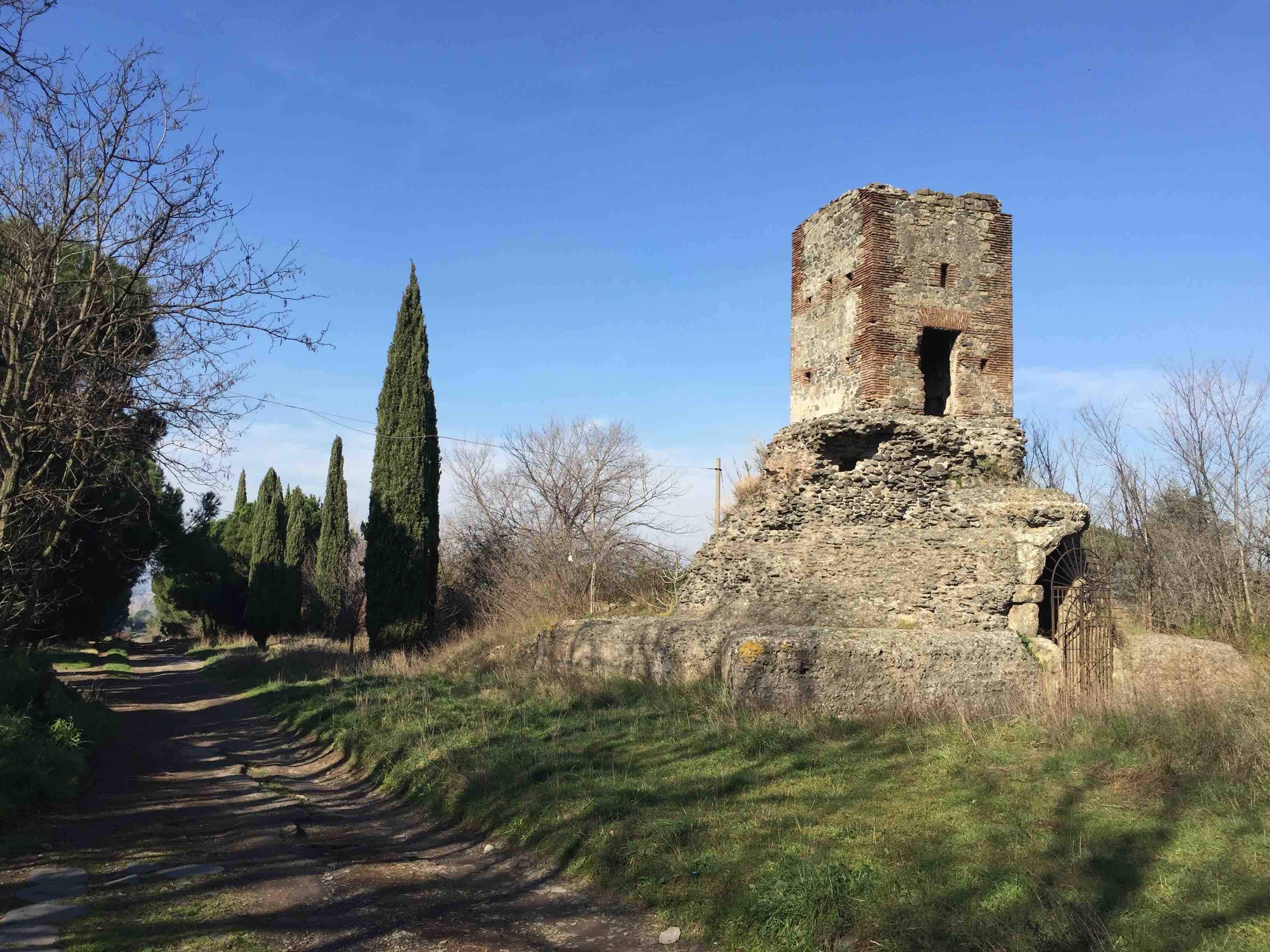
At the time of the measure of the base of P. Secchi, the tomb was not surmounted by the tower visible today because it was built in July 1870 following the official participation of the Papal States to the measure of the Central European degree, geodetic project proposed by Prussia in 1862 for the study of the shape of the Earth. For this reason the tower was then named after Secchi. The tower, ca. 5.20 m high , has within it a pillar on which the Italians placed a trigonometric point on the charts. Still today we observe the holes that were seat of a wooden ladder to carry out the measurements at the top (Figure 2).
Extreme B
Torre Secchi, Via Appia Antica, Frattocchie (Marino, RM)
41°46’08.3”N 12°36’49.9”E (datum WGS84-ETRF2000)
Bibliography:
C. Maire, R.G. Boscovich: De litteraria expeditione per pontificiam ditionem ad dimetiendos duos meridiani gradus et corrigendam mappam geographicam, Roma, 1755, pp. 516; N.M. Tilliard: Voyage astronomique et geographique, dans l’État de l’Eglise entrepris par l’order et sous les auspices de pape Benoit XIV: pour mesurer deux dégrés du méridien, et corriger la carte de l’Etat eccleśiastique par les pp. Maire et Boscovich, traduzione dal latino, Parigi, 1770, pp. 526; G. Ricchebach: Esame imparziale della triangolazione del P.G. Boscovich, Roma, 1846, pp. 118 (memoria postuma); J.B. Coraboeuf : Notice sur les operations geodesiques que les ingenieurs-geographes français executerent a Rome an 1809 et 1810 in Bulletin de la Societé de Geographie, V, n. 30, giugno 1853, pp. 353-374 e V, luglio 1853, pp. 5-26 ; T. Aebischer, C. Rossetti, G. Filippi, E. Iannuzzi: La Base geodetica di Secchi sulla via Appia Antica (XIX sec.): il caposaldo B in Fasti On Line Documents & Research Italy, 254; T. Aebischer, a cura di: La scoperta del caposaldo B della base geodetica di A. Secchi lungo la via Appia Antica, Città di Castello (PG), 2013, pp. 65; T. Aebischer: Ricerche geodetico-topografiche presso la torre Secchi alle Frattocchie (via Appia Antica, comune di Marino) in Bollettino Unione Storia ed Arte, terza serie, 8, gennaio-dicembre 2013, pp. 61-70; T. Aebischer: La via Appia Antica parco geodetico. Fonti letterarie e online sulle basi geodetiche di Boscovich e Secchi misurate per la cartografia dello Stato Pontificio e lo studio della forma della Terra (XVII-XXI secc.), Città di Castello (PG), 2014, pp. 233; F. Zonetti, A. Liberace, T. Aebischer, V. Albano, R. Tozzo: Torre Secchi (Frattocchie): dai rilievi Laser Scanner e fotogrammetrici al plastico per il museo della base geodetica dell’Appia Antica in Atti XX Conferenza ASITA, Cagliari, 8-10 novembre 2016, pp. 925-930.